搜索结果: 1-15 共查到“地理学其他学科 GIS”相关记录28条 . 查询时间(0.078 秒)

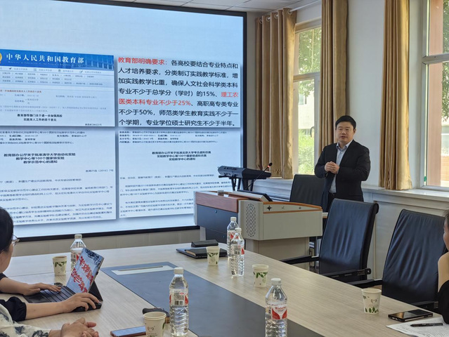
2024年6月7日中午,南京师范大学地理科学学院张书亮教授为石河子大学理学院旅游与地理系教师做了题为“‘GIS综合实验’国家级一流本科课程教学改革探索与实践”的教学研究报告,中国矿业大学杨慧教授和石河子大学理学院党委书记任建、副院长徐丽萍,旅游与地理系党总支张春香及系老师参加了本次会议。

江苏省地理学会、江苏省遥感与GIS学会2014年会圆满落幕(图)
江苏省地理学会 江苏省遥感与GIS学会 2014 年会
2014/12/12
为进一步推动江苏省地理学的交流与发展,江苏省地理学会、江苏省遥感与地理信息系统学2014年度学术交流大会于2014年12月4-6日在南通召开。本次会议以“陆海统筹发展与地理学创新”为主题。会议由江苏省地理学会、江苏省遥感与地理信息系统学会主办,南通大学地理科学院承办,中国科学院南京地理与湖泊研究所、南京大学、南京师范大学协办。来自南京大学、南京师范大学、南通大学、中国科学院南京地理与湖泊研究所、河...
GIS approach in assessing the status of neritic water quality and petroleum hydrocarbons in Bay of Bengal (From Chennai to Nagapattinam, Tamilnadu), India
GIS coastal water quality petroleum hydrocarbons wind direction wetland
2014/11/26
Neritic coastal water samples, collected onboard in Ocean Research Vessel (Sagar Purvi,
NIOT) at a depth of 15m from the shore in August, 2010 at 15 coastal stations (opposite to
the river mouths,...
Monitoring of bank line erosion of River Ganga, Malda District, and West Bengal: Using RS and GIS compiled with statistical techniques
River Migration banks failure paradigm shift mitigation of disasters
2014/11/26
The creation of regional imbalance, inequalities and differentiation in India, starts with the
physiographic element and ends with economic, and socio-cultural parameters of the
inhabitants/popula...
Geo-Hydrological study of Gandheshwari Sub-watershed using Remote Sensing and GIS Techniques
Geo-hydrology hydro-geomorphology remote sensing GIS and GPS
2014/11/26
The present study was conducted on Gandheshwari sub-watershed situated in Bankura
district of West Bengal. The remote sensing and GIS techniques have been proved to be very
efficient in...
Evaluation of hydrogeomorphological landforms and lineaments using GIS and Remote Sensing techniques in Bargur – Mathur subwatersheds, Ponnaiyar River basin, India
Hydrogeomorphology Lineament Remote Sensing GIS Bargur – Mathur
2014/11/26
The Landsat ETM satellite data is used to demarcate hydrogeomorphological landforms and
lineaments to evaluate groundwater potential of the study area. The Bargur - Mathur
subwatersheds of Ponnaiy...
GIS based lineament Delineation using geophysical resistivity data, Karur district, Tamil Nadu, India
Lineament Geophysical resistivity DEM GIS
2014/11/26
The paper shows that geophysical resistivity values Digital Elevation Model (DEM) for
different depths, can indicate the location of depth persistence lineaments. The depth
persistence lineaments ...
Online web GIS- based services for spatial data and sharing of leptospirosis epidemiology information; Development of pilot project in Mahasarakham province Thailand
Web GIS-based service spatial data sharing leptospirosis epidemiology
2014/11/26
Leptospirosis epidemiology Information sharing is important for the shared preparation,
response, and recovery stages of sickness control. Leptospirosis epidemiology phenomena
are powerfully assoc...
Land use and cover change assessment using Remote Sensing and GIS: Dohuk City, Kurdistan, Iraq (1998-2011)
Land Use/Cover GIS Remote Sensing Urban Growth Landsat imagery Dohuk
2014/11/25
Land cover undergoes continuous changes around the world, especially in highly populated
areas. This phenomenon can be attributed to human activities including population growth
and the need of mo...
Identification of urban sprawl dynamics in a rapid growing city using GIS
Urban Sprawl Shannon’s Entropy urban growth GIS and RS Sprawl dynamics
2014/11/24
Urban development is a phenomenon in developing countries. The measurement and
monitoring of urban sprawl is crucial for government officials and planners who urgently
need updated information and...
Morphometric analysis using Geographic Information System (GIS) for sustainable development of hydropower projects in the lower Satluj river catchment in Himachal Pradesh, India
Morphometric classification Drainage density Stream orders Hydropower
2014/11/24
Remote Sensing and Geographic Information System techniques are effectively being used in
recent times as an important tool in determining the quantitative description of morphometry
of a basin. T...
Trends analysis of river bank erosion at Chandpur, Bangladesh: A remote sensing and GIS approach
Riverbank erosion Channel shifting Remote sensing GIS Bangladesh
2014/11/24
Bangladesh which is mainly formed by alluvial deposits faces riverbank erosion very often
due to regular shifting of river channels. The present study has undertaken to study the trends
of riverba...
Role of Remote Sensing and GIS in artificial recharge of the ground water aquifer in Ottapidaram taluk, Tuticorin district, South India
Hydrogeology artificial recharge groundwater aquifer
2014/11/24
The world population is expected to double by the middle of the next century, to about 10.6
billion people. More than 80% of these people will live in what is presently known as the
"Third World."...
冲沟是多种外力作用的结果,展示为多种地貌现象。选择胶东半岛北岩子口小流域作为研究对象,以正射影像(DOM)和数字高程模型(DEM)为数据源,选择土地利用、地形湿度指数、坡度坡长因子、水流动力指数、坡向、平面曲率和地表粗糙度等7个地貌因子,计算小流域土壤侵蚀敏感性,研究侵蚀冲沟与地貌因子的关系。结果表明:冲沟多发生在坡度坡长较大、水流动力强、地表湿度较低的林草地区域,多分布在阳坡的凹面;冲沟大多分布...

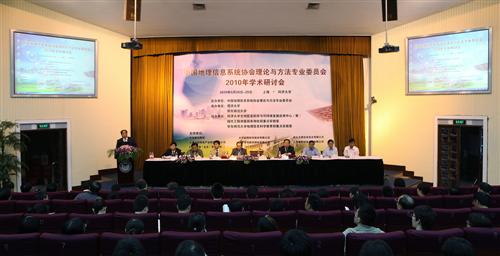
2010年9月28日至29日,“中国地理信息系统协会理论与方法专业委员会2010年学术研讨会” 在我校召开。会议由中国地理信息系统协会理论与方法专业委员会主办,同济大学、华东师范大学承办。会议以“GIS,让生活更美好”为主题,与会专家围绕地理信息科学、空间数据处理、GIS工程、空间分析、地理信息服务、GIS新技术应用及遥感、GPS应用前沿理论和技术问题进行了深入交流与系统研讨,以促进我国GIS理论...

