搜索结果: 1-15 共查到“国际动态 地壳与地形学”相关记录20条 . 查询时间(2.324 秒)

地球陆地形成时间比预期早5亿年(图)
地球陆地 形成时间 早5亿年
2021/4/28
地球大陆地壳的形成可能比科学家先前的估计早5亿年。科学家指出,确定地球陆地的出现时间,有助于了解原始生命的起源条件。今天,新的海洋地壳在大洋中脊升起,那里正是构造板块漂移的地方。而大陆地壳通常要古老得多,且由火山作用形成。在火山作用下,板块相互碰撞,在海平面上形成一个更厚、密度更小的地层。
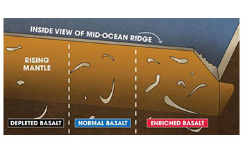
Geochemists solve mystery of Earth's vanishing crust(图)
Geochemists solve mystery Earth vanishing crust
2020/7/10
Earth's crust is the solid, outermost layer of our planet. Much of what happens below that layer remains a mystery, including the fate of sections of crust that vanish back into the Earth.Now, a team ...

A steaming cauldron followed the dinosaurs' demise(图)
steaming cauldron followed dinosaurs' demise
2020/6/5
A new study reveals that the Chicxulub impact crater may have harbored a vast and long-lived hydrothermal system following the catastrophic impact event linked to the extinction of the dinosaurs 66 mi...
Tectonic plates started shifting earlier than previously thought(图)
Tectonic plates started shifting previously thought
2020/5/9
An enduring question in geology is when Earth's tectonic plates began pushing and pulling in a process that helped the planet evolve and shaped its continents into those that exist today. Some researc...
Scientists determine early Earth was a ‘water world’ by studying exposed ocean crust(图)
Scientists early Earth water world’ exposed ocean crust
2020/3/13
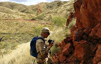
The Earth of 3.2 billion years ago was a "water world" of submerged continents, geologists say, after analyzing oxygen isotope data from ancient ocean crust now exposed on land in Australia. The findi...

New Details Emerge On Temperature,Mobility Of Earth’s Lower Crust In Rocky Mountains(图)
New Details Temperature Mobility Earth’s Lower Crust Rocky Mountains
2018/2/1
Everything on the surface of the Earth rests on massive tectonic plates that resemble a jelly sandwich, with two rigid pieces — the upper crust and the upper mantle — enclosing a gooey middle layer of...

Data mining finds more than expected beneath Andean Plateau(图)
data mining more than expected andean plateau
2017/9/5
Seismologists investigating how Earth forms new continental crust have compiled more than 20 years of seismic data from a wide swath of South America’s Andean Plateau and determined that processes the...
Experiments call origin of Earth's iron into question
Experiments call origin Earth's iron
2017/3/14
New research from The University of Texas at Austin reveals that the Earth’s unique iron composition isn’t linked to the formation of the planet’s core, calling into question a prevailing theory about...
Geologic imaging technique measures strength of Earth’s outer shell
Geologic imaging technique measures strength Earth’s outer shell
2016/10/10
An advanced imaging technique used to map Earth’s outer shell also can provide a measure of strength, finding weak spots and magma upwellings that could point to volcanic or earthquake activity, accor...
UW Researchers Advance Understanding of Mountain Watersheds
UW Researchers Mountain Watersheds
2015/11/12
University of Wyoming geoscientists have discovered that the underground water-holding capacity of mountain watersheds may be controlled by stresses in the earth’s crust. The results, which may have i...
North American Plate Shattered Speed Records -- a Billion Years Ago
North American Plate Shattered Speed Records
2015/3/4
North America traveled in fast company back in its youth.A new study led by Michigan Technological University geophysicist Aleksey Smirnov reveals that 1.1 billion years ago, the North American tecton...
加拿大发现26亿年前地下古水
加拿大 26亿年前 地下古水
2013/5/21
据美国《发现》杂志近日报道,研究人员在加拿大2.4公里深的矿井中发现了具有26.4亿年历史的地下水,其可能保存着古地球的气候变迁记录,甚至还可能握有火星生命的栖息地等线索。报告发表在最新出版的《自然》期刊上。
“卡西尼号”绘制首份土卫六地形图(图)
卡西尼号 首份 土卫六地形图
2013/5/20
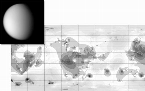
土卫六直径达5150千米,不仅是土星最大的一颗卫星,它的大小也超过了水星和冥王星。遗憾的是,土卫六的大气层厚度比地球大气层要厚,并且包含的深色薄雾也遮蔽了其表面(如图)。日前,绕土卫六轨道运行的卡西尼号探测器,用雷达测量了土卫六表面的高地和深处。在7月刊的《伊卡洛斯》杂志上,行星科学家公布了土卫六的首份地形图。在主图像中,按照上北下南的方向,根据不同的颜色标识了土卫六上海拔最高的地方,以及海拔最低...
美国航天局2013年5月15日说,该机构研究人员已利用“卡西尼”号探测器获得的数据,绘制了土星最大卫星——土卫六(“泰坦”)的首份地形图。土卫六是太阳系中已知唯一有着厚厚大气层的卫星,其天空有云层,表面有山脉与河流,天文学家称之为太阳系中与地球最相似的星体。但土卫六表面的液体不是水,而是甲烷。


