搜索结果: 1-15 共查到“工学 accuracy,”相关记录353条 . 查询时间(0.125 秒)

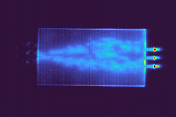
Lithography-free photonic chip offers speed and accuracy for AI(图)
Artificial Intelligence Electrical Computer Engineering
2023/6/27


A new way to perform "general inverse design" with high accuracy(图)
通用逆设计 SMART 特性识别材料 机器学习
2023/6/7
A COMPARATIVE STUDY AMONG THREE REGISTRATION ALGORITHMS: PERFORMANCE, QUALITY ASSURANCE AND ACCURACY
Accuracy Automation Least Squares Registration'Terrestrial Laser Scanning
2019/3/4
A critical task in every terrestrial laser scanning project is the transformation (addressed to as registration or alignment) of multiple point clouds into a common reference system. Even though this ...
COMPARISON WITH ACCURACY OF TERRESTRIAL LASER SCANNER BY USING POINT CLOUD ALIGNED WITH SHAPE MATCHING AND BEST FITTING METHODS
laser scanning time of flight phase shift shape matching natural distributions Ostia
2019/3/4
Recently operation systems of laser scanning have been obviously improved; for instance shape matching has been equipped with software on a post processing stage so measurement without any targets is ...
ACCURACY ASSESSMENT OF 3D MODELS GENERATED FROM GOOGLE STREET VIEW IMAGERY
Spherical Photogrammetry Equi-rectangular Panoramas Accuracy
2019/3/1
Google Street View is a technology implemented in several Google services/applications (e.g. Google Maps, Google Earth) which provides the user, interested in viewing a particular location on the map,...
IDENTIFICATION OF LOW ACCURACY REGIONS IN LAND COVER MAPS USING UNCERTAINTY MEASURES AND CLASSIFICATION CONFIDENCE
Multispectral images Classification Uncertainty Confidence Accuracy Spatial variation
2018/11/9
The aim of this article is to assess if the data provided by soft classifiers and uncertainty measures can be used to identify regions with different levels of accuracy in a classified image. To this ...
AN OPEN SOURCE APPROACH FOR THE INTRINSIC ASSESSMENT OF THE TEMPORAL ACCURACY, UP-TO-DATENESS AND LINEAGE OF OPENSTREETMAP
Data Quality Lineage Open Source OpenStreetMap Temporal Accuracy Thematic Accuracy Up-to-dateness
2018/11/8
OpenStreetMap (OSM) is the most popular crowdsourced geographic information project. The main factor that still limits the practical use of OSM is the lack of quality assurance. OSM quality assessment...
AN INTERFEROMETRIC PROCESSING METHOD TO MAINTAIN BOTH ACCURACY AND RESOLUTION OF DEM USING GAOFEN-3 SAR DATA
Gaofen-3, TanDEM-X, DEM, multi-look
2018/5/14
Gaofen-3 (GF-3) is the only in-orbit SAR satellite of China civilian fields. It is designed especially for ocean observation but not for interferometric applications. However, during the past one and ...
COMPARISON AND ANALYSIS OF ACCURACY OF ELEVATION EXTRACTION BASED ON THE ZY-3 01 AND 02 SATELLITES STEREOSCOPIC IMAGES
ZY-3 Stereoscopic Satellite GSD DEM differential DEM, Accuracy
2018/5/16
The ZY-3 is the civil high-resolution optical stereoscopic mapping satellite independently developed by China. The ZY-3 constellation of the twin satellites operates in a sun-synchronous, near-polar, ...
THE ANALYSIS OF BURROWS RECOGNITION ACCURACY IN XINJIANG'S PASTURE AREA BASED ON UAV VISIBLE IMAGES WITH DIFFERENT SPATIAL RESOLUTION
Rodent disaster monitoring, UAV, Low altitude remote sensing, Multi-spatial scale, Object-based image analysis, Grassland protection
2018/5/15
The rodent disaster is one of the main biological disasters in grassland in northern Xinjiang. The eating and digging behaviors will cause the destruction of ground vegetation, which seriously affecte...
PRELIMINARY EVALUATION OF GAOFEN-3 POLARIMETRIC AND RADIOMETRIC ACCURACY BY CORNER REFLECTORS IN INNER MONGOLIA
Gaofen-3 Quality evaluation Polarimetric Radiometric accuracy
2018/5/15
On August 10, 2016, China launched its first C-band full polarimetric radar satellite, named Gaofen-3 (GF-3), for urban and agriculture monitoring, landslide detection, ocean applications, etc. Accord...
PRELIMINARY GAOFEN-3 INSAR DEM ACCURACY ANALYSIS
GF-3 satellite, error analysis, calibration, digital elevation model, precision validation
2018/5/11
GF-3 satellite, the first C band and full-polarization SAR satellite of China with spatial resolution of 1 m, was successfully launched in August 2016. We analyze the error sources of GF-3 satel...
REAL-TIME TROPOSPHERIC PRODUCT ESTABLISHMENT AND ACCURACY ASSESSMENT IN CHINA
Real-time Tropospheric delay GNSS reference stations Grid product Accuracy assessment Convergence speed
2018/5/11
Tropospheric delay has always been an important issue in Global Navigation Satellite System (GNSS) processing. Empirical tropospheric delay models are difficult to simulate complex and volatile atmosp...
ACCURACY DIMENSIONS IN REMOTE SENSING
accuracy data quality data dimensions uncertainty metrics procedures
2018/5/11
The technological developments in remote sensing (RS) during the past decade has contributed to a significant increase in the size of data user community. For this reason data quality issues in remote...


