搜索结果: 1-15 共查到“工学 complex”相关记录255条 . 查询时间(0.777 秒)

郭新闻论文成果:Self-Assembly of Mn(II)-Annidoximated PAN Polymeric Beads Complex as Reusable Catalysts for Efficient and Stable Heterogeneous Electro-Fenton Oxidation
heterogeneous electro-Fenton porous polymeric frameworks phase inversion postsynthetic grafting strong metal-support interaction
2023/3/6
A facile postsynthetic amidoxime modification method was reported on the preparation of transition-metal ions (Mn, Fe, and Co)-polyacrylonitrile (PAN) polymeric beads complex as reusable catalysts for...
The oxygen sensing mechanism of a triphenylamine-based cyclometalated platinum(II) complex
Oxygen sensing Luminescence mechanism Quenching
2023/3/1
Triphenylamine-based cyclometalated platinum(II) (TCP) emits phosphorescence at room temperature. The phosphorescence was quenched by oxygen molecule, which means that TCP is a good candidate for oxyg...


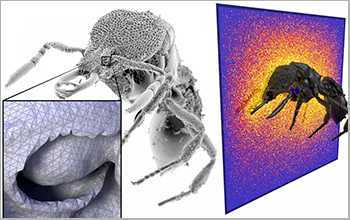
Researchers at Carnegie Mellon University have developed an efficient new way to quickly analyze complex geometric models by borrowing a computational approach that made photorealistic anima...
GENERATION OF GIGAPIXEL ORTHOPHOTO FOR THE MAINTENANCE OF COMPLEX BUILDINGS. CHALLENGES AND LESSON LEARNT
Photogrammetry orthophoto architecture modelling Cultural Heritage 3D survey
2019/3/4
This study is part of the “Milan Cathedral Survey project”. It is a three years long research project with the aim of surveying the entire cathedral in 3D with different techniques (mainly photogramme...
A COMBINED APPROACH FOR SURVEYING COMPLEX COASTAL SITES
Coastal Sites Mobile Mapping System 3D Laser Scanner
2019/3/2
This study presents an integrated approach for reading coastal sites. A process aimed at protecting and enhancing these sites must be developed alongside a targeted interdisciplinary strategy, closely...
3D MODELLING AND VIRTUAL REALITY APPLIED TO COMPLEX ARCHITECTURES: AN APPLICATION TO HOSPITALS’ DESIGN
HBIM healthcare facilities 3D modelling hospitals’ management aser scanning
2019/3/1
There are many healthcare facilities in Spain that were built throughout the second half of the 20th century, and compose an interesting built heritage designed by outstanding architects of the archit...
IMMERSIVE WAYFINDING: VIRTUAL RECONSTRUCTION AND EYE-TRACKING FOR ORIENTATION STUDIES INSIDE COMPLEX ARCHITECTURE
Wayfinding Virtual reality Eye-tracking Architecture simulation Occupant’s behaviour
2019/3/1
The study presents a process of digital simulation that aims to investigate the legibility of multiple spaces in a complex architecture through architectural survey, virtual reconstruction and 3D visu...
THE “DIAGNOSTIC SURVEY”: A METHODOLOGY FOR THE KNOWLEDGE OF A COMPLEX ARCHITECTURAL PALIMPSEST
diagnostic survey knowledge elevation’s stratigraphic readings
2019/3/1
A multidisciplinary approach that availing of the use of different techniques, such as topography, three-dimensional laser scans, photogrammetry, archival studies and stratigraphical analysis, can per...
HISTORICAL SDI, THEMATIC MAPS AND ANALYSIS OF A COMPLEX NETWORK OF MEDIEVAL TOWERS (13TH–15TH CENTURY) IN THE MOORISH STRIP
GIS, Historical SDI, Spatial Data Analysis, Visibility, Medieval heritage, Towers of Moorish Strip
2018/11/9
This work is part of an investigation into the use of GIS for the documentation and comprehension of medieval architectural heritage in the ancient Kingdom of Seville. The research was done in the fra...
AN ADAPTIVE SHIP DETECTION ALGORITHM FOR HRWS SAR IMAGES UNDER COMPLEX BACKGROUND: APPLICATION TO SENTINEL1A DATA
HRWS SAR Real-time ship detection Adaptive sliding window GLCM Sentinel1A
2018/5/14
Real-time ship detection using synthetic aperture radar (SAR) plays a vital role in disaster emergency and marine security. Especially the high resolution and wide swath (HRWS) SAR images, provides th...
FISHEYE MULTI-CAMERA SYSTEM CALIBRATION FOR SURVEYING NARROW AND COMPLEX ARCHITECTURES
Fisheye Photogrammetry Multi-camera Calibration Accuracy Cultural Heritage Survey Narrow Spaces
2018/6/4
Narrow spaces and passages are not a rare encounter in cultural heritage, the shape and extension of those areas place a serious challenge on any techniques one may choose to survey their 3D geometry....


