搜索结果: 1-15 共查到“地质学 study”相关记录390条 . 查询时间(0.237 秒)

New study helps pinpoint when Earth's plate subduction began(图)
New study pinpoint when Earth plate subductiona
2020/12/18
A U.S. National Science Foundation-funded study by scientists at the Scripps Institution of Oceanography and the University of Chicago sheds light on a major question in Earth sciences:...

No social distancing in the Cretaceous:New study finds earliest evidence for mammal social behavior(图)
No social distancing Cretaceous earliest evidence mammal social behavior
2020/11/6
A new study led by U.S. National Science Foundation-funded paleontologists at the University of Washington and its Burke Museum of Natural History & Culture indicates that the earliest ...

中国地质大学科学技术发展院代旭(博士生),宋海军*,地学院/BGEG国家重点实验室. Paleobiology(2020), Toward an understanding of cosmopolitanism in deep time: a case study of ammonoids from the middle Permian to the Middle Triassic(图)
生物;地理网络;计算方法;中二叠世;中三叠世;全球;菊石;地理
2021/10/15
近日,中国地质大学地球科学学院2018级博士生代旭为第一作者的研究论文“Toward an understanding of cosmopolitanism in deep time: a case study of ammonoids from the middle Permian to the Middle Triassic” 刊发在国际著名古生物学期刊《Paleobiology》上,该文通讯...

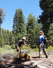
Study explores how rock expands near soil surface in Sierra Nevada(图)
rock expands soil surface Sierra Nevada
2019/10/18
A University of Wyoming researcher and his team have discovered that weathering of subsurface rock in the southern Sierra Nevada Mountains of California is due more to rocks expanding than to chemical...

Sloths, which once roamed the Americas, ranged from tiny, cat-sized animals that lived in trees to massive ground sloths that may have weighed up to six tons. The only species we know today are two-to...

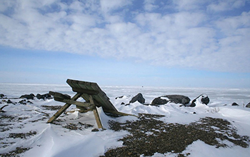
Study of northern Alaska could rewrite Arctic history(图)
northern Alaska Arctic history mineral wealth economic development
2019/10/30
Parts of Alaska's mountainous Brooks Range were likely transported there from Greenland and a stretch of the Canadian Arctic much farther to the east, according to a series of studies detailing more t...

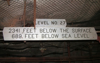
Scientists take cues from Jules Verne to study life at the 'center of the Earth'(图)
Scientists Jules Verne center of the Earth
2019/11/22
In a modern-day journey to the center of the Earth, scientists are exploring the depths of the Soudan Underground Mine in Minnesota's Vermilion Range.There the researchers are working to understand th...
中国地质大学科学技术发展院张帆(博士研究生),焦养泉*,等. 资源学院 构造与油气资源教育部重点实验室. AAPG Bulletin, JAN 2019. Enhancement of organic matter maturation due to radiogenic heat from uranium: A case study from the Ordos Basin in China
砂岩型;铀矿;碳质碎屑;成熟;演化;催化效应
2021/10/20
近日,中国地质大学资源学院焦养泉教授团队在国际顶级期刊《AAPG Bulletin》上刊发研究成果,首次报道发现了砂岩型铀矿对围岩碳质碎屑的成熟演化具有催化效应,即“碳质碎屑Ro的放射性催化效应”。国际同行给予了高度评价:"I very welcome you case study on the radiogenic heat of uranium enhancement of organic m...
中国地质大学科学技术发展院伏海蛟 严德天 等 资源学院构造与油气资源教育部重点实验室 AAPG Bulletin (2018), A study of hydrogeology and its effect on coalbed methane enrichment in the southern Junggar Basin, China
准噶尔盆地;南缘水;动力场;主导;煤层;气富
2021/10/21
近期,国际石油地质重要期刊《AAPG Bulletin》刊发了中国地质大学针对准噶尔盆地南缘水动力场主导下煤层气富集成藏机制的最新研究成果,论文第一作者为中国地质大学资源学院伏海蛟副教授,共同作者分别为资源学院严德天教授、庄新国教授、李国庆副教授,中国地质大学(北京)汤达祯教授,澳大利亚联邦科学与工业研究院潘哲君教授等。
STUDY ON THE DISTRIBUTION OF GEOLOGICAL HAZARDS BASED ON FRACTAL CHARACTERISTICS – A CASE STUDY OF DACHUAN DISTRICT
Geologic Hazard Fractal Theory Fractal Dimension Self Correlation Risk Zoning
2018/5/15
It is a complicated process to analyze the cause of geological hazard. Through the analysis function of GIS software, 250 landslides were randomly selected from 395 landslide hazards in the study area...
STUDY ON KARST INFORMATION IDENTIFICATION OF QIANDONGNAN PREFECTURE BASED ON RS AND GIS TECHNOLOGY
Karst Landsat-5 TM Image RS+DEM Slope Karst Rocky Desertification
2018/5/16
Karst area is a pure natural resource base, at the same time, due to the special geological environment; there are droughts and floods alternating with frequent karst collapse, rocky desertification a...
URBAN SHANTY TOWN RECOGNITION BASED ON HIGH-RESOLUTION REMOTE SENSING IMAGES AND NATIONAL GEOGRAPHICAL MONITORING FEATURES – A CASE STUDY OF NANNING CITY
Gray-level co-occurrence matrix shanty town residential suitability nearest neighbour
2018/5/14
Urban shanty towns are communities that has contiguous old and dilapidated houses with more than 2000 square meters built-up area or more than 50 households. This study makes attempts to extract shant...
STUDY ON DESERTIFICATION MONITORING FROM 2000 TO 2014 AND ITS DRIVING FACTORS THROUGH REMOTE SENSING IN NINGXIA,CHINA
Ningxia Desertification Rainfall Use Efficiency Grey Relational Analysis Driving Factors Precipitation
2018/5/17
Due to the implementation of national policy, the desertification in Ningxia has been gradually reduced, but the overall situation of desertification is still serious. Rainfall Use Efficiency(RUE) can...
LANDSLIDE IDENTIFICATION FROM IRS-P6 LISS-IV TEMPORAL DATA-A COMPARATIVE STUDY USING FUZZY BASED CLASSIFIERS
Kashmir earthquake CBSI LISS-IV Vegetation Index Temporal PCM
2018/4/18
While extracting land cover from remote sensing images, each pixel in the image is allocated to one of the possible class. In reality different land covers within a pixel can be found due to continuum...
FLOOD VULNERABILITY REDUCTION, USING A PARTIAL PARTICIPATORY GIS APPROACH. A STUDY CASE IN BAJA CALIFORNIA SUR, MEXICO
Participatory cartography loods cyclones vulnerability reduction
2018/4/18
A partial participatory GIS approach was implemented in a community in La Paz, Baja California Sur, Mexico to reduce vulnerability of floods caused by cyclones. A workshop was held to locate areas sus...

